


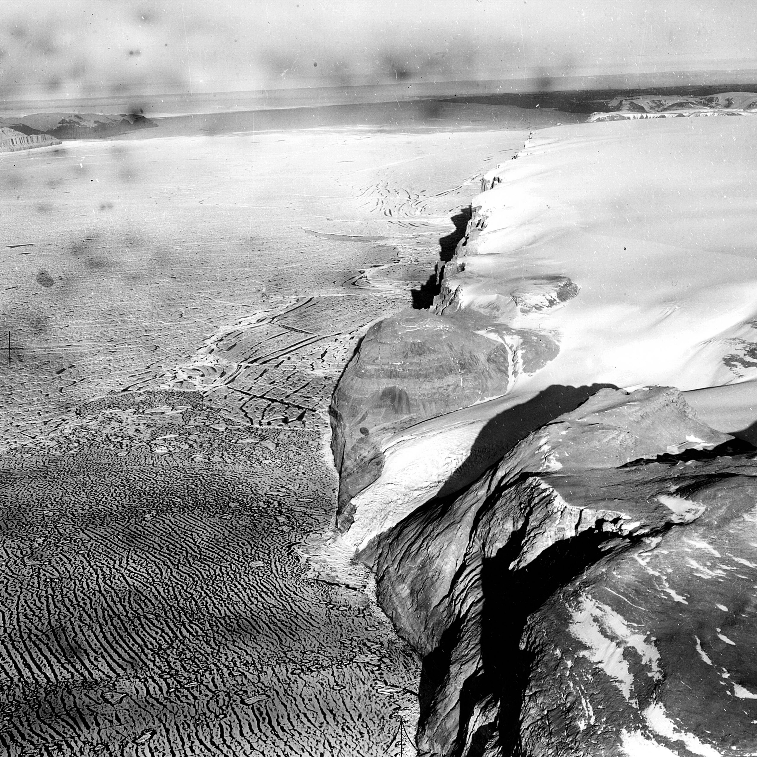
Here is what satellites recorded before, during and after the 76-square-kilometre break-off — and why glaciologists are watching what the loss means for the ice behind it.
A section of ice roughly the size of Manhattan broke away from Greenland’s Petermann Glacier on August 4, 2026, producing a free-floating ice island measuring about 76 square kilometres. The separation took place at the glacier’s floating tongue in northwestern Greenland, where the ice extends off the bedrock and out over the water.
What set this event apart was the observation record around it. Satellite imagery tracked stress fractures spreading across the ice surface in the days and weeks before the final break, allowing researchers to watch a large calving event build toward failure rather than piece it together after the fact.
The calving is one of the most significant tracked at Petermann in recent years, and it lands in a glacier system that scientists have flagged as increasingly unstable over the past two decades.
Key Details at a Glance
| Detail | Information |
|---|---|
| Event | Calving of an ice island from a floating glacier tongue |
| Date | August 4, 2026 |
| Location | Petermann Glacier, northwestern Greenland |
| Size of ice island | Approximately 76 square kilometres |
| Size comparison | Roughly comparable in area to Manhattan |
| How it was observed | Satellite imagery tracking crack formation and progression |
| Direct sea level contribution | None from the floating ice itself |
| Named research institutions | Not specified |
| Confirmed cause of this specific break | Not specified |
How Satellites Watched the Fracture Spread
Space-based imaging systems detected fractures widening across the glacier surface before the break, revealing the mechanical stresses acting on the ice as it weakened. The visible progression effectively signalled that a large calving event was approaching.
Real-time observation: Researchers were able to follow the structural failure as it developed rather than reconstruct it from before-and-after images.
Limits of prediction: Advance warning that a break was coming did not translate into a precise date. Ice failure depends on internal flaws, temperature, ocean conditions and tidal flexing that are difficult to model exactly.
That combination — clear early signals, uncertain timing — is a recurring theme in modern glaciology and shapes how researchers frame their forecasts publicly.
Background: Petermann’s Record of Instability
Petermann Glacier drains a substantial portion of the Greenland Ice Sheet and discharges into Arctic waters, which makes its behaviour a widely used indicator of conditions across the region.
The glacier has produced major calving events before, releasing ice islands of comparable scale in earlier years. Taken together, those episodes point to a pattern of retreat rather than a single anomaly.
Scientists have generally attributed the instability at Petermann to two pressures working in tandem: warming ocean water eroding the floating tongue from beneath, and atmospheric warming that increases surface melt while reducing accumulation.
Why This Matters: Floating Ice Versus Grounded Ice
Ice that is already floating displaces its own weight in water, so when it breaks free it does not by itself raise sea level. The significance of an event like this lies elsewhere.
The buttressing effect: A floating ice tongue acts like a brake on the grounded ice behind it. When that tongue shrinks or collapses, inland ice can flow faster toward the ocean — and grounded ice reaching the sea does add to sea level.
Scale of the reservoir: The Greenland Ice Sheet holds enough frozen water to raise global sea levels by approximately 7 metres if it were to melt entirely, which is why the stability of individual outlet glaciers draws international attention.
In short, the ice island is less important as a volume of water than as a signal about what the system behind it may do next.
The Arctic Amplification Context
The calving fits within a broader trend of accelerating Arctic ice loss over roughly the past three decades. Studies have shown Greenland’s rate of mass loss increasing substantially since the early 2000s.
Faster warming: The Arctic has been warming at roughly twice the global average rate, an effect known as Arctic amplification.
Reinforcing feedback: As reflective ice and snow retreat, darker ocean and land surfaces are exposed. Those surfaces absorb more solar energy, which drives further warming and further ice loss.
This feedback loop helps explain why high-latitude regions respond so sharply to relatively modest global temperature changes.
How Modern Glacier Monitoring Works
Continuous observation of Greenland’s glaciers now relies on a mix of instruments rather than a single sensor, operated by space agencies and research institutions.
Optical imagery captures visible surface features, including crevasses and rifts, when cloud cover and daylight allow.
Radar works through cloud and darkness, which matters greatly during long polar winters, and can reveal changes in surface texture and movement.
Laser altimetry measures ice surface elevation, helping researchers estimate thinning and mass change over time.
Combining these datasets produces maps of ice velocity, thickness and structural change that would have been impossible to assemble from occasional field expeditions alone.
What Happens to the Ice Island Now
Once separated, an ice island drifts under the influence of ocean currents, winds and sea ice conditions. Over time it fractures into smaller pieces and melts as it encounters warmer water.
Large fragments can persist for extended periods and are typically tracked because they pose navigation considerations in shipping lanes and can interact with offshore infrastructure in some regions.
Researchers also treat the exposed calving front as a study opportunity, since it shows how the remaining tongue has been reshaped and where the next weak points may form. Specific tracking plans for this ice island are Not specified.
Policy and Adaptation Implications
Events of this scale feed directly into long-running debates about emissions reduction and coastal planning. Accelerating ice loss from Greenland and Antarctica is one of the primary drivers of projected sea level rise.
Mitigation framing: International climate agreements have emphasised limiting global warming to 1.5 degrees Celsius above pre-industrial levels as a way to reduce ice loss and slow sea level rise.
Adaptation on the ground: Low-lying communities have been pursuing measures such as infrastructure upgrades, managed retreat planning and early warning systems.
Neither track is affected by a single calving event on its own, but repeated large losses are the kind of evidence that shapes how urgent those conversations become.
Editorial Note
This article reports on a glaciological event and the scientific context surrounding it. Figures such as the 76-square-kilometre area and the August 4, 2026 date reflect the information available at the time of publication and may be refined as further analysis is released.
Where details such as institutional attribution or the confirmed trigger for this specific break were not available, they are listed as Not specified rather than estimated. This publication is independent and is not affiliated with any government body or space agency.
Frequently Asked Questions
Does a calving ice island directly raise sea level? No. Ice that is already floating displaces water and does not add to sea level when it breaks off. The concern is that losing the floating tongue can allow grounded ice upstream to flow faster into the ocean, which does raise sea level.
How large is a 76-square-kilometre ice island? It is roughly comparable in area to Manhattan, making it one of the largest calving events observed at Petermann in recent years.
Where exactly is the Petermann Glacier? It is located in northwestern Greenland and drains a significant portion of the Greenland Ice Sheet into Arctic waters.
Why do scientists pay close attention to this glacier? Because it drains a large catchment and has a floating tongue whose behaviour serves as an indicator of wider ice sheet stability and regional climate trends.
How do satellites detect cracks in glaciers? Optical sensors capture rifts as visible linear features, radar detects changes in surface reflectivity and can operate through cloud and darkness, and laser altimetry tracks elevation change that can signal thinning.
Is a calving event of this size unusual? Petermann has produced large calving events before, but the frequency and scale of recent losses point to an acceleration associated with a warming Arctic.
What happens to the ice island over time? It drifts with ocean currents and gradually breaks apart and melts as it moves into warmer water. Smaller fragments can persist for extended periods.
Why is the Arctic warming faster than the rest of the planet? Through Arctic amplification. As bright ice and snow retreat, darker ocean and land absorb more solar heat, reinforcing the warming that caused the ice loss in the first place.
Can researchers predict the exact date of the next major calving? Not reliably. Monitoring can reveal that stress is building and that a break is likely, but the precise timing depends on complex ice mechanics that remain difficult to model.