


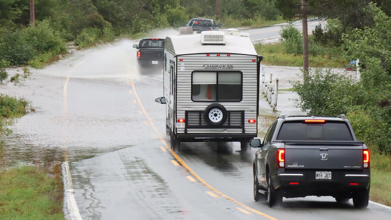
How a rainstorm that was never called a hurricane broke bridges, cut off two Richmond County communities and left three Nova Scotia counties under emergency orders.
Cape Breton flooding left much of northeastern Nova Scotia under emergency orders through Sunday, Sept. 6, after a storm that was never classified as a hurricane dropped more than 200 millimetres of rain on several communities, tore out bridges and culverts, and closed scores of roads. Richmond, Inverness and Victoria counties, along with the Town of Port Hawkesbury, all declared states of local emergency on Saturday, and one woman was found dead in a flooded area of Richmond County.
By Sunday afternoon the water was receding, but the emergency declarations stayed in force for a reason officials were blunt about: nobody could yet vouch for the ground under the pavement. Two communities remained cut off, and provincial crews were still counting the damage.
Why Richmond County Called It Category 1 Damage
Richmond County, on Cape Breton’s southeast corner, took the worst of it. Warden Lois Landry said the community is no stranger to tropical weather, estimating it sees roughly one hurricane a year, but described this system as behaving differently from what residents are used to.
“We saw trees down across roads on people’s property,” Landry said. “That’s really Category 1 hurricane-level damage and that just wasn’t in the forecast.”
That gap between the forecast and the outcome is the through-line of the whole event. The storm brought strong winds, thunderstorms and rainfall totals above 200 millimetres in several communities, yet it was neither forecast as nor declared a hurricane. Officials said water reached places that had never flooded before, which is precisely the kind of surprise that overwhelms drainage designed for historical conditions rather than current ones.
The Washed-Out Bridge on West Bay Road
The St. Georges Channel bridge on West Bay Road in Richmond County washed away early Saturday morning, stranding people on the far side. A second Richmond County community, River Bourgeois, was also cut off by washouts and remained isolated on Sunday.

Landry said restoring emergency access to those two pockets was the county’s first priority. The harder problem, she added, is the infrastructure that looks intact but was submerged for hours and may not be.
“We have had road washouts before. We have had power outages before that have not required a state of emergency,” she said. “What gave us pause and what directed our action in this instance was really not having a confident sense that the roads we were driving on, the bridges we were driving over, were safe.”
That uncertainty is why the state of emergency persisted even as skies cleared. A road that carries a car today can fail under the same car next week if the culvert beneath it has been scoured out.
120 Roads Damaged, 54 Still Closed, Two Bridges Beyond Repair
Nova Scotia’s Department of Public Works gave the clearest numerical picture of the damage. Spokesperson Gary Andrea said in an email on Sunday that highway crews had been working continuously since the storm hit.
- At the peak: more than 120 roads were closed or damaged by flooding.
- As of Sunday: 54 roads remained closed, with the remainder fully or partially reopened.
- Bridges: eight were damaged, and two will need to be replaced outright.
Most roads across the three rural counties are provincially owned, which places the bulk of the repair burden on the province rather than on municipal budgets. Replacement bridges, in particular, are multi-season projects rather than quick patches.

The Death Confirmed in a Flooded Area of Richmond County
RCMP confirmed that a 46-year-old woman who had been reported missing was found dead in a flooded area of Richmond County. Police would not confirm a cause of death.
Landry said the human loss reframed everything else the county was dealing with. “We’re staggered by the extent of the damage and the likelihood of what all that’s going to cost,” she said. “All of that pales in comparison to waking up and getting confirmation of a death of a resident as a result of this weather event.”
Residents Standing Watch Where There Were No Barricades
With crews stretched and washouts appearing faster than signage could be installed, residents filled the gap themselves. Landry said neighbours volunteered to stay awake overnight to flag down motorists approaching compromised roads in places where there had been no time or resources to erect barricades.
The risk they were managing was visible on Route 4 near River Bourgeois, where vehicles, including tourists driving Alberta and Quebec plates, pushed through an overflowing brook on Saturday. Visitors unfamiliar with local roads are among the most exposed in this kind of event, because they have no baseline for what a given crossing normally looks like.
Inverness, Victoria and Port Hawkesbury Fared Very Differently
The storm’s impact varied sharply across the island, which is why the four emergency declarations were on different tracks by Sunday night.

In Inverness County, on the island’s west side, water spilled over roads, some trees came down and power outages were scattered. Warden Bonny MacIsaac said electricity had largely been restored by Sunday afternoon and damage assessments were underway. “The integrity of a lot of roads [is] certainly a main concern right now,” she said.
Victoria County, which stretches from mid-island to Cape Breton’s northern tip, came through in the best shape. Warden Jackie Organ said damage was minimal and residents were “very lucky,” adding that she expected the state of emergency to be lifted Sunday evening pending word from public works and the emergency management office.
The heavily populated Cape Breton Regional Municipality also escaped the worst. Streets and roads closed by rising water there were reopened later on Saturday.
Port Hawkesbury Expects a Significant Repair Bill
Port Hawkesbury is in a different position from the rural counties because most of the town’s streets are its own responsibility rather than the province’s. Mayor Brenda Chisholm-Beaton said it would likely be days before the full impact is known, but the cost is expected to be significant for a town of its size.
A large tree came down and damaged Prince Street, and asphalt near the corner of Old Sydney Road and Bernard Street will need repair. The town is built on a hill running down to the Strait of Canso, Chisholm-Beaton noted, so runoff funnelled downhill and submerged low-lying areas.

What the Cape Breton Flooding Signals About Rural Road Networks
General context, not specific to any single claim in this event: rural Atlantic Canadian road networks depend heavily on small culverts and single-span bridges, and many of those structures were sized for rainfall patterns recorded decades ago. When a system delivers more than 200 millimetres in roughly a day, the failure point is rarely the highway surface itself, it is the drainage underneath it.
That is also why post-storm inspection takes longer than the cleanup that residents can see. Debris removal and power restoration happen within days. Confirming that a submerged bridge abutment or a scoured culvert bed is still structurally sound is engineering work, and until it is done, officials have little choice but to keep closures in place.
For communities that have historically measured storm risk by wind speed and hurricane category, this event is a reminder that an unnamed rainfall system can produce comparable damage without ever triggering the warnings people are conditioned to watch for.
Where Things Stood at the End of the Weekend
Going into the start of the week, the states of emergency in Richmond and Inverness counties and in Port Hawkesbury remained active, with Victoria County’s expected to lift first. Restoring access to River Bourgeois and St. Georges Channel was the immediate operational priority, 54 provincial roads were still closed, and two damaged bridges were already slated for full replacement. Damage assessments by both the province and the municipalities were still in progress.
Frequently Asked Questions
How much rain fell during the Cape Breton storm?
Rainfall totals topped 200 millimetres in several communities, accompanied by strong winds and thunderstorms.

Was this storm officially a hurricane?
No. It was neither forecast as nor declared a hurricane, though Richmond County Warden Lois Landry described the damage as comparable to a Category 1 event.
Which areas declared a state of emergency?
Richmond, Inverness and Victoria counties declared states of local emergency on Saturday, along with the Town of Port Hawkesbury.
How many roads and bridges were affected?
More than 120 roads were closed or damaged at the peak, 54 remained closed as of Sunday, and eight bridges were damaged with two requiring replacement.
Why did emergency orders stay in place after the water went down?
Officials said they could not yet confirm that roads and bridges submerged during the storm were structurally safe to use.